
Your phone stamps GPS coordinates into nearly every photo it takes — accurate enough to point at your house. This free tool removes only the location data from a JPG or PNG photo and leaves everything else untouched: the camera model, the date, and the exposure settings stay in the file.
It runs entirely in your browser, so the photo is never uploaded. Keep the photography details you want, drop the location you do not. If you would rather wipe every hidden field, use the full EXIF Remover, and to check what location a photo holds first, use the Photo Location Map Viewer.
How to use
- Drop a JPG or PNG photo into the tool (up to 50 MB) or click to choose one.
- The tool reads the file and shows the GPS coordinates it found, if any.
- Remove the GPS tags — latitude, longitude, and altitude are deleted.
- Download the clean copy; the camera, date, and exposure data remain in the file.
Why use Toolsvine
A photo of your kid's birthday can quietly carry your home coordinates, and a marketplace listing photo can reveal where the item is stored. Yet the rest of the metadata — camera, date, settings — is often worth keeping. This tool is the precise fix: it deletes only the location tags, so you keep the photography record and lose the address.
What exactly counts as GPS data in a photo?
GPS data in a photo is a small group of EXIF fields: GPS latitude, GPS longitude, GPS altitude, and sometimes the direction the camera faced and the time the fix was taken. Together they place the shot on a map, usually within a few feet when the phone had a clear sky view.
Indoors the fix can be less precise, but it still points at the right building.
Phones add these tags silently whenever location permission is on, and most people never notice. The coordinates survive email attachments and file transfers, and they are still there when the photo is re-shared months later. Removing them is a one-time, permanent fix for that file.
GPS fields removed — and what stays
| Field | After this tool |
|---|---|
| GPS latitude / longitude | Removed |
| GPS altitude | Removed |
| Camera make / model | Kept |
| Date taken | Kept |
| Shutter speed, aperture, ISO | Kept |
| Pixels and dimensions | Kept |
Worked example: a photo taken at home in Austin
A photo taken in your backyard in Austin, Texas, carries GPS 30.2672° N, 97.7431° W, plus the camera details: iPhone 15 Pro, 1/500 s, f/1.8, ISO 64, taken 03/15/2026 at 2:10 PM. After this tool, the same photo still says iPhone 15 Pro, 1/500 s, f/1.8, ISO 64, 03/15/2026 at 2:10 PM.
But the GPS fields are gone, the file size is about 3 KB smaller, and no map can place the shot anymore.
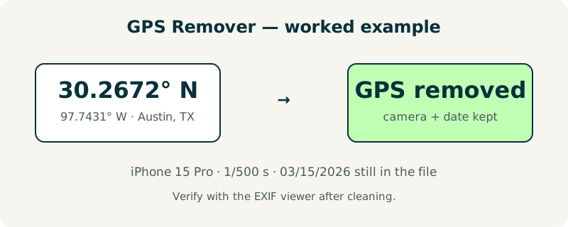
Check it yourself: run a photo through the tool, then open the result in the EXIF viewer — the GPS section will be empty while the camera section is unchanged.
When is removing only the GPS enough?
It is enough whenever the location is the sensitive part and the rest is harmless: portfolio shots, photography forums, product listings, and photos shared with people you trust. The date and camera data rarely identify you on their own, and keeping them helps others learn from the shot.
It is not enough when the photo itself identifies you — a visible house number, a school uniform, a license plate — because the image content, not the metadata, is the leak. In that case, crop the photo with the Image Cropper first, then strip the GPS here, and for total privacy use the full EXIF Remover instead.
Frequently asked questions
Does removing GPS data change the photo's quality?
No. Only the small GPS fields are deleted from the metadata block; the pixels, dimensions, and colors are completely untouched. The file comes back about 3 KB smaller, because the location tags themselves take only a few kilobytes. Visually, the cleaned photo is identical to the original in every way.
Will this tool remove the location from a screenshot or a downloaded image?
Screenshots and downloaded images usually carry no GPS tags in the first place, so the tool will report that no location data was found and the file is returned unchanged. The tool is designed for photos taken with a phone or camera, which is where GPS tags actually live. It is safe to run on any JPG or PNG up to 50 MB.
Is my photo uploaded to a server during the process?
No. Everything happens in your browser, on your device, and the photo never leaves it. There is no account, no upload, and nothing stored after you close the tab. That is the whole point of a local tool: the location data you are trying to protect never travels across the internet in the first place.
What is the difference between this tool and the full EXIF remover?
This tool deletes only the GPS location fields and keeps the camera model, exposure settings, and date. The full EXIF remover deletes all of those fields, leaving a photo with no hidden data at all. Choose this one when you want to keep the photography record, and the full remover when you want a completely clean file.
Can a photo still be located after the GPS tags are removed?
Not from the file itself — the coordinates are gone for good. But the photo's visible content can still give clues: street signs, landmarks, and house numbers can identify a place to anyone who looks. If the image itself shows where you are, crop or blur that part first, then remove the GPS tags.