
Where exactly was that photo taken? This free tool reads the GPS coordinates stored inside a JPG or PNG photo and shows the spot on an interactive map — no upload, no account, and the photo never leaves your browser.
It is the fastest way to answer a question every traveler and photographer asks: “Where was this?” Drop in the photo, and the pin lands on the map. To see all the other data a photo holds, use the EXIF Data Viewer, and to remove the location before sharing, use the GPS Location Remover.
How to use
- Drop a JPG or PNG photo into the tool (up to 50 MB) or click to choose one.
- The tool reads the GPS latitude and longitude from the photo's EXIF data.
- An interactive map opens with a pin at the exact spot where the photo was taken.
- Zoom in to see the street, or copy the coordinates to use in another map app.
Why use Toolsvine
GPS coordinates like 30.2672, −97.7431 mean nothing until you see them on a map — then they instantly become “Zilker Park, Austin.” This tool closes that gap in one step, locally, without uploading a photo that contains your location to a stranger's server. Travelers recover forgotten spots, photographers revisit a viewpoint, and anyone can check what a photo reveals before sharing it.
How does a photo know where it was taken?
When you take a photo with location permission on, your phone records its GPS position at the moment the shutter fires and writes it into the photo's EXIF data as a latitude and longitude pair. A clear sky view gives accuracy within a few feet.
Indoors or in a city canyon the fix can drift, but it still lands on the right building or block.
The coordinates are just numbers until a map draws them. This tool reads the pair — for example 30.2672° N, 97.7431° W — and places a pin on an interactive map, so the numbers become a street, a park, or a trailhead you can recognize at a glance.
What the map shows for each photo
| Detail | Example |
|---|---|
| Latitude / longitude | 30.2672° N, 97.7431° W |
| Place | Zilker Park, Austin, TX |
| Altitude | 149 m above sea level |
| Date taken | 03/15/2026, 4:32 PM |
Worked example: a sunset photo from Zilker Park
A sunset photo from Austin carries GPS 30.2672° N, 97.7431° W. Drop it in, and the map opens centered on Zilker Park, with the pin on the lawn by Barton Springs Road — the same spot where the photographer stood.
The coordinates are accurate to about 5 meters, which is close enough to tell which side of the park the shot came from.
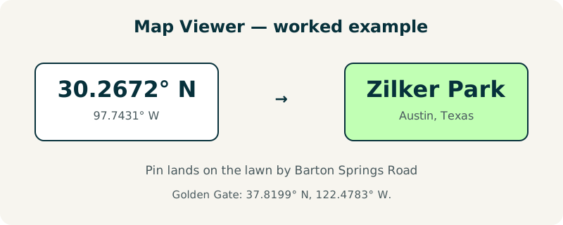
Try it with a vacation photo whose location you have forgotten: the pin usually jogs the memory faster than any filename. A second test: a Golden Gate photo at 37.8199° N, 122.4783° W lands on the bridge's south vista point.
What if the photo shows no location on the map?
Three causes cover almost every case. First, the photo may never have had GPS data — screenshots, downloads, and photos taken with location off carry none. Second, an app may have stripped it: messaging apps and social networks routinely remove location when they re-encode a photo.
Third, the photo may be a scan or an export, which has no camera fix at all.
In that case the tool says so plainly instead of guessing. If you want to add a location to an old photo, the EXIF Data Editor lets you type the coordinates in, and if a photo reveals too much, the GPS Location Remover deletes the tags.
Frequently asked questions
Is my photo uploaded to a server to show it on the map?
No. The photo is read locally in your browser, and only the GPS coordinates — two numbers — are used to place the pin. The image itself never leaves your device, and nothing is stored after you close the page. That matters because the location in a photo is personal, and uploading it to a server would defeat the purpose of checking it privately.
How accurate is the location shown on the map?
Outdoors with a clear sky, a phone GPS fix is usually accurate to about 5 meters, or 16 feet — close enough to tell which side of a park you stood on. Indoors, underground, or between tall buildings the fix can drift by a block or more. The photo also stores an accuracy hint in some cases, but the pin is always placed exactly where the recorded coordinates say.
Can this tool find the location of a screenshot or downloaded image?
Usually not, because screenshots and downloaded images almost never contain GPS data. The coordinates are written by the camera app at the moment a photo is taken, so a file that was never a camera shot has nothing to read. If the tool reports no location, that is the answer — the photo simply does not carry one.
Do all phones save GPS data in photos?
Nearly all do, but only when location permission is on for the camera app. iPhones and Android phones both write GPS tags by default, and you can turn it off in the camera settings. If you turn it off, new photos carry no location at all — which is the simplest privacy setting, and one worth checking before a trip.
Can I copy the coordinates to use in Google Maps or Apple Maps?
Yes. The tool shows the latitude and longitude as plain numbers, for example 30.2672, −97.7431, which you can paste into any map app or search box. That is also the easiest way to double-check the spot on a bigger screen, or to share a meeting point without sending the original photo and its data along.